Northampton, Pennsylvania History, Geography, and Culture
สรุปใจความสำคัญ
- Northampton was a global center for cement manufacturing, primarily due to the Atlas Portland Cement Company.
- The borough produced a significant portion of the cement used to build the Panama Canal.
- The local school mascot, the 'Konkrete Kid,' reflects the town's industrial heritage.
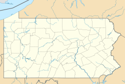
Northampton is a borough located in Northampton County, Pennsylvania, United States. With a population of 10,395 as of the 2020 census, this community is a key part of the Lehigh Valley metropolitan area. It is strategically positioned 7.8 miles north of Allentown, 66.7 miles northwest of Philadelphia, and 93.8 miles west of New York City.
History and the Cement Industry
Northampton was formed in 1902 through the unification of three villages: Siegfried, Newport, and Stemton. The borough's identity is deeply intertwined with the limestone formations of the region, which transformed it into a global hub for cement manufacturing.
The Atlas Portland Cement Company, which operated from 1895 to 1982, was one of the largest cement companies in the world for much of the 20th century. Notably, it produced approximately eight million barrels of cement used in the construction of the Panama Canal. In 1909, the company petitioned to change the area's status to a borough to streamline mail services.
Cultural Legacy
The legacy of the cement industry remains strong today. The Northampton Area School District uses the "Konkrete Kid" as its mascot, and the Atlas Memorial Cement Museum, opened in 1997, commemorates the immigrant workers from Poland, Ukraine, and Austria who helped build the industry. Another local tradition is the Northampton Jack Frost Parade, held every October to celebrate the arrival of winter.
Geography and Climate
Northampton is situated at 40°41′2″N 75°29′29″W, approximately 8 miles north of Allentown and 15 miles west of Easton. The borough covers a total area of 2.7 square miles, with the Lehigh River forming its western border, separating Northampton County from Lehigh County.
The region experiences a hot summer humid continental climate (Dfa), with average monthly temperatures ranging from 28.8°F in January to 73.7°F in July. The local hardiness zone is 6b.
Government and Demographics
The borough is governed by a borough manager, an assistant borough manager, and eight elected council members, with two representing each ward.
2020 Census Data
- Population: 10,395
- Median Age: 41.1 years
- Urban Population: 100%
- Housing: 4,321 households, with 43.6% being married-couple households.
คำถามที่พบบ่อย
What is the significance of the Atlas Portland Cement Company to Northampton?
The company was one of the largest in the world for much of the 20th century and established Northampton as a global center for cement manufacturing, employing thousands of residents and immigrants.
Where is Northampton located in relation to major cities?
It is located 7.8 miles north of Allentown, 66.7 miles northwest of Philadelphia, and 93.8 miles west of New York City.
What is the Northampton Jack Frost Parade?
It is a historical community event held every October before Halloween that celebrates the onset of winter with marching bands and floats.