Căușeni District History, Geography, and Economy of Moldova
สรุปใจความสำคัญ
- Căușeni District was the first district in Moldova to be recorded, dating back to 1455.
- The economy is heavily reliant on agriculture, with 80.5% of the land used for farming, specifically vineyards and orchards.
- The district is located in the Dniester River basin, with the Botna River as its primary tributary.
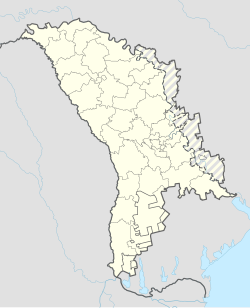
Căușeni District (Romanian: Raionul Căușeni) is a district located in the central part of Moldova. Its administrative center is the city of Căușeni, and another major urban center is Căinari. According to the 2024 Moldovan census, the district has a population of 57,261 people.


History
The Căușeni District holds a significant place in regional history, being the first district of Moldova to be recorded in 1455. Other localities such as Zaim, Cîrnățeni, and Fîrlădeni were recorded later, between 1535 and 1573. During the 16th to 18th centuries, the region saw a surge in population driven by the development of intensive agriculture and wine-making.
A notable architectural landmark is the Assumption Church, built in 1761 in Căușeni city, which is renowned for its beautiful interior frescoes. The region's political status shifted several times: it was occupied by the Russian Empire in 1812, united with Romania in 1918, and later became part of the USSR in 1940. Following Moldova's independence in 1991, the district underwent further administrative changes before becoming a formal administrative unit of Moldova in 2003.
Geography and Climate
Located in the southern part of Moldova, Căușeni District is bordered by Ialoveni and Anenii Noi to the north, Slobozia to the east, Ștefan Vodă to the south-east, Ukraine to the south, and Cimișlia to the west.


Relief and Climate
The terrain is predominantly flat, with maximum altitudes reaching 220–230 meters and minimums of 20–30 meters on the Lower Dniester plain. The district experiences a continental climate with an annual average temperature of 11 °C. July averages around 23 °C, while January averages -4 °C. Annual precipitation ranges between 450 and 550 mm.
Flora and Fauna
The forests are composed of oak, ash, hornbeam, linden, maple, and walnut. The fauna is typical of Europe, featuring mammals such as foxes, hedgehogs, deer, wild boar, and various bird species including eagles and starlings.
Hydrography
The district is situated within the Dniester River basin, with the Botna River (152 km) serving as its main tributary. Most of the lakes in the region are artificial.
Administrative Subdivisions
The district is organized into 48 localities, consisting of 2 cities and 46 villages distributed across 28 communes. The two primary cities are Căușeni and Căinari.
Demographics
As of the 2024 Census, the population is 57,261, with 27% residing in urban areas and 73% in rural areas. The population is overwhelmingly Christian, with 96.9% identifying as Orthodox Christians and 2.1% as Protestant.

Economy and Education
The economy is primarily driven by agriculture and manufacturing. There are over 15,000 registered companies, focusing on wine-making, milk processing, and bakery products. Agriculture is dominant, with 80.5% of the total land area (93,700 ha) dedicated to agricultural use, including significant portions of vineyards and orchards.
In terms of education, the district operates 69 educational institutions, including 37 secondary schools and 31 kindergartens, supporting thousands of students and children.
คำถามที่พบบ่อย
What is the administrative center of Căușeni District?
The administrative center of the district is the city of Căușeni.
What is the primary religion in Căușeni District?
The vast majority of the population is Christian, with 96.9% identifying as Orthodox Christians.
What are the main economic activities in the region?
The main economic activities are agriculture and manufacturing, with a strong focus on wine-making and milk processing.
บทความที่เกี่ยวข้อง
 01การท่องเที่ยวและประวัติศาสตร์
Căușeni District
Chițcani หมู่บ้านประวัติศาสตร์และอาราม Noul Neamț ในมอลโดวา
อ่านบทความฉบับเต็มอ่านต่อ →Eastern Europe
Bloodlands Europe Between Hitler and Stalin Explained
อ่านบทความฉบับเต็มอ่านต่อ → 03ประวัติศาสตร์และการเมือง
ประวัติศาสตร์และการเมือง